Entry #75
The Human Layer
Hoorain Mahvar
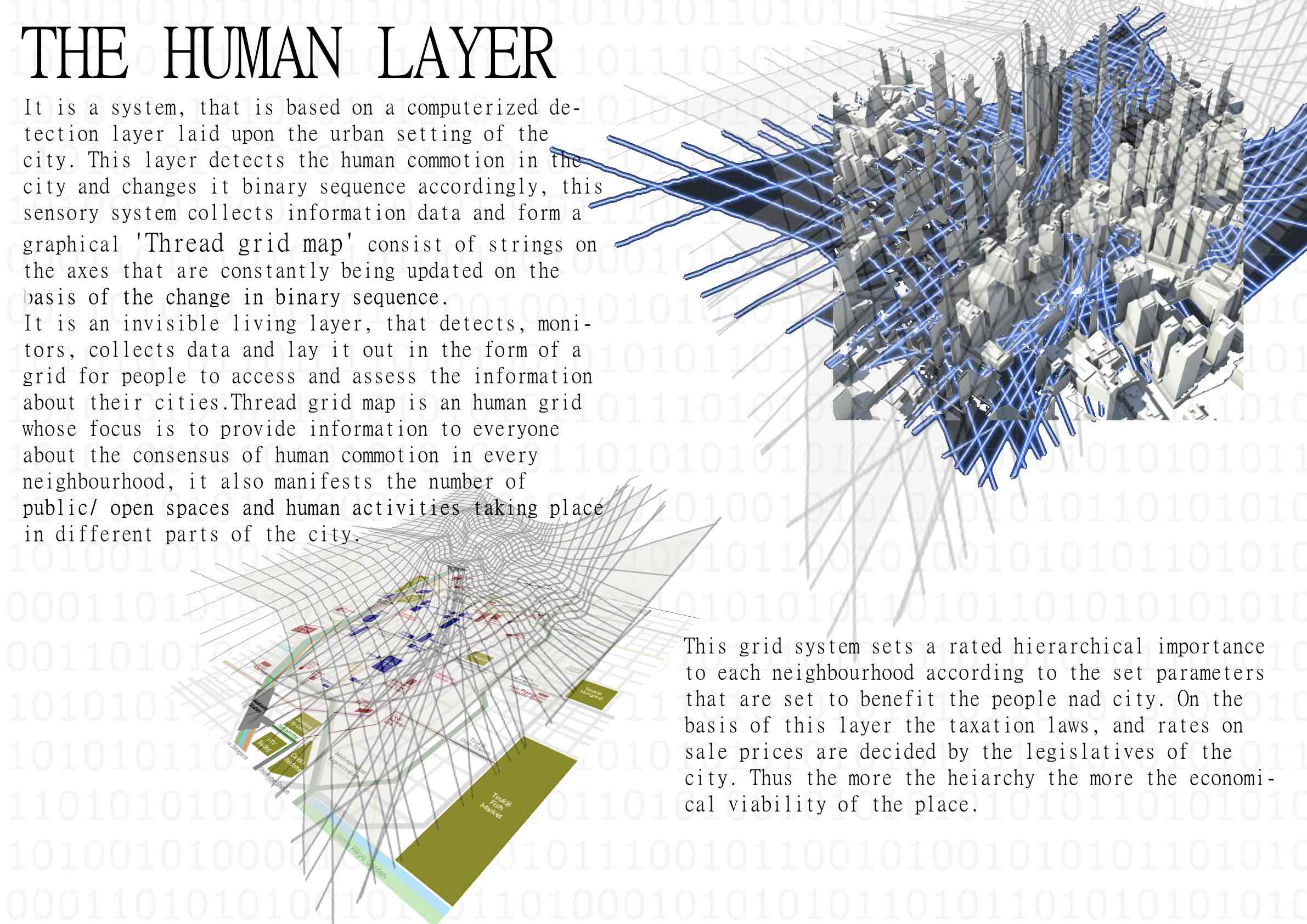
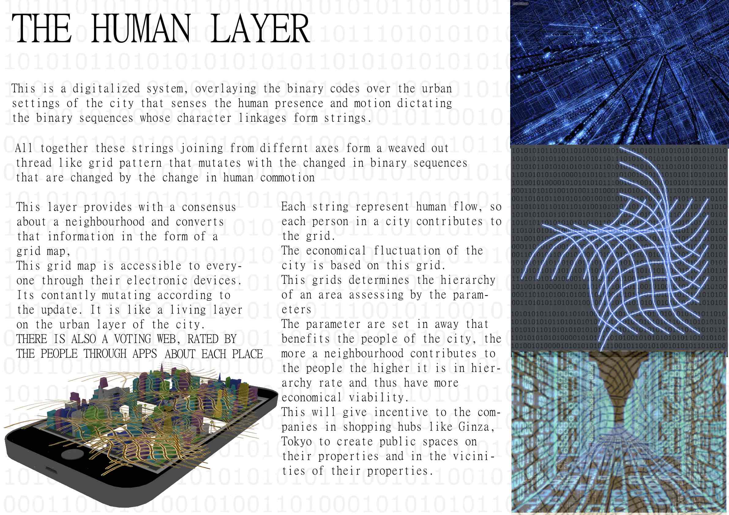
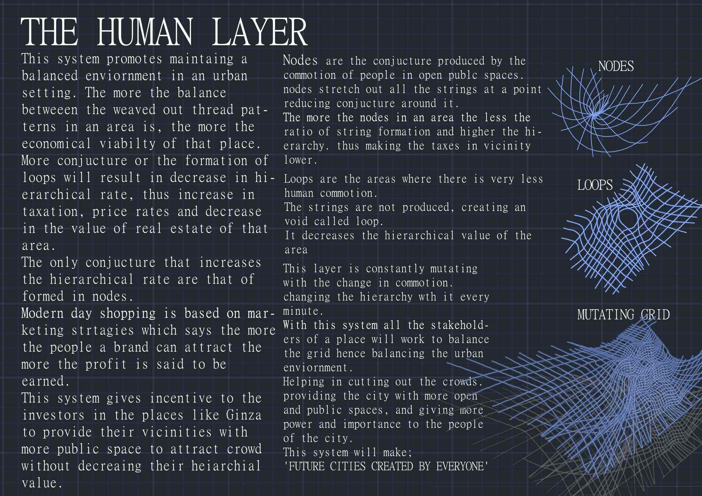


A plan involving the creation of a "thread grid map", a map that represents the level of human activity (monitored through a citywide sensing system) in each part of the city. The constantly-changing grid map can be seen using electronic devices, and can be used to guide urban policy, investment decisions, etc.
- Metadata:
-
• The degree to which advanced technologies (including IT) are used
3 (Low-tech) 1 - 2 - 3 (High-tech) -
• Site-specificness: The degree to which the idea targets a specific locale
2 (Site-agnostic/universal) 1 - 2 - 3 (Site-specific) -
• Degree of commercial potential
2 (Strictly for public good) 1 - 2 - 3 (May profit some parties involved) -
• Time scale of citizen-led changes to cities enabled by the idea
2 (Short-term change) 1 - 2 - 3 (Long-term change) -
• Geographic scale of citizen-led changes to cities enabled by the idea
3 (Small-scale change) 1 - 2 - 3 (Large-scale change) -
• Hurdles toward participation, from a citizen’s perspective
1 (Anyone can participate) 1 - 2 - 3 (Requires expertise, time, money, etc.)